Southern Utah National Parks
(Lots of photos - loads slowly - please be patient - best viewed on a computer monitor.)
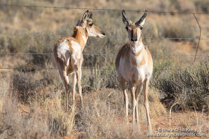
The last two weeks of April we traveled to southern Utah for our first visit to all five Utah national parks, a couple of state parks and more. We visited Arches, Zion, Bryce Canyon, Capitol Reef, and Canyonlands national parks, the Joshua Tree Forest in the Mojave Desert in southwest Utah, Snow Canyon State Park near St. George, UT; and Valley of Fire State Park in Nevada, both state parks are also in the Mojave Desert. The five national parks are a part of the 'Colorado Plateau' a geologic area that has pushed up thousands of feet of sedimentary rock to form a vast kidney shaped plateau covering parts of Utah, Arizona, New Mexico and Colorado. It includes many national parks, national monuments, state parks, and recreation areas, and because of millions of years of geologic forces and erosion has some of the most spectacular scenery in the country. It is hard to describe the beautiful scenery, desert and rock formations that we saw, so we took lots of photos. We did not see a lot of wildlife or birds, which was a little surprising, but in this desert climate many of the animals are nocturnal.
Click an image in each section below to view in a slide show.
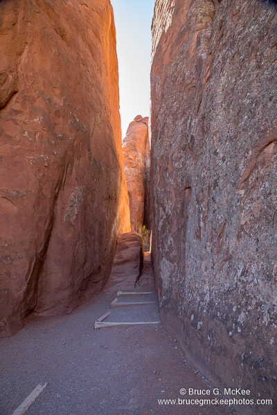
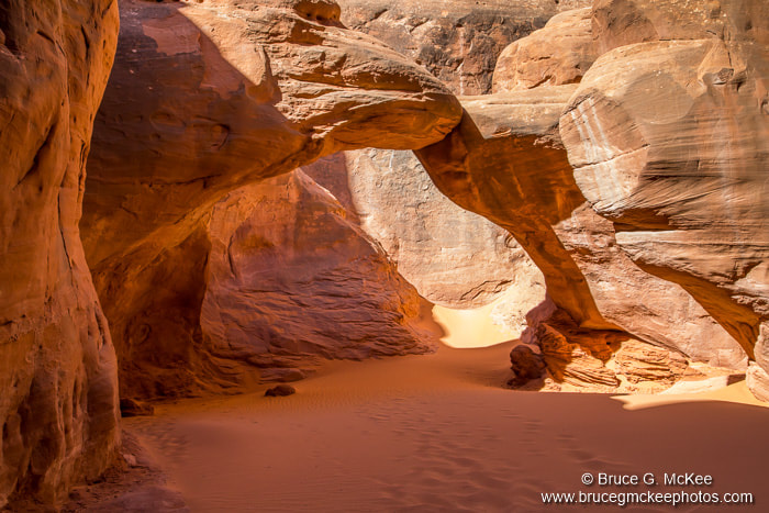
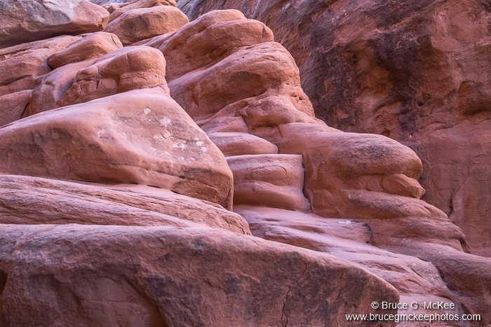
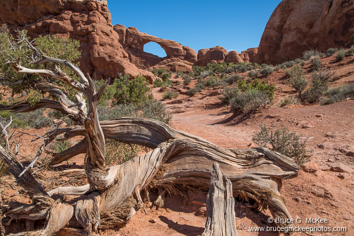
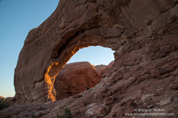
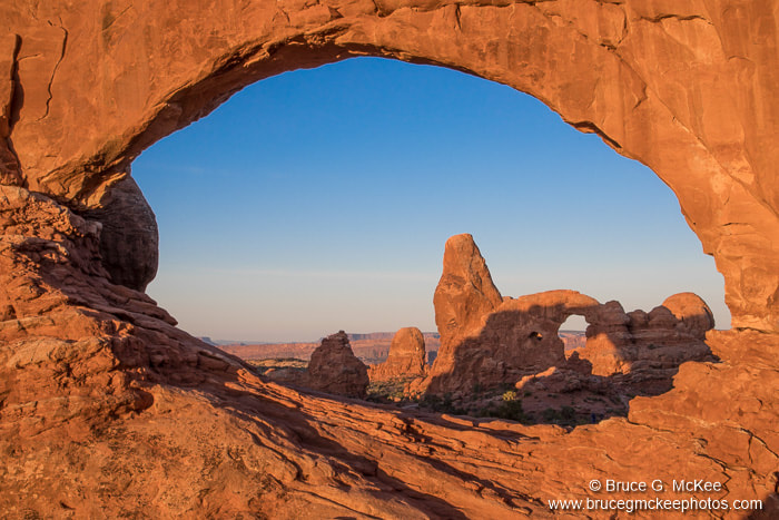
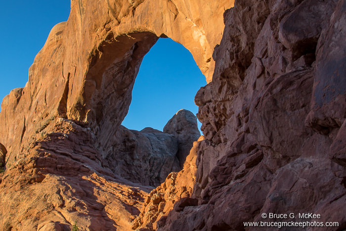
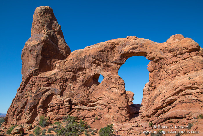
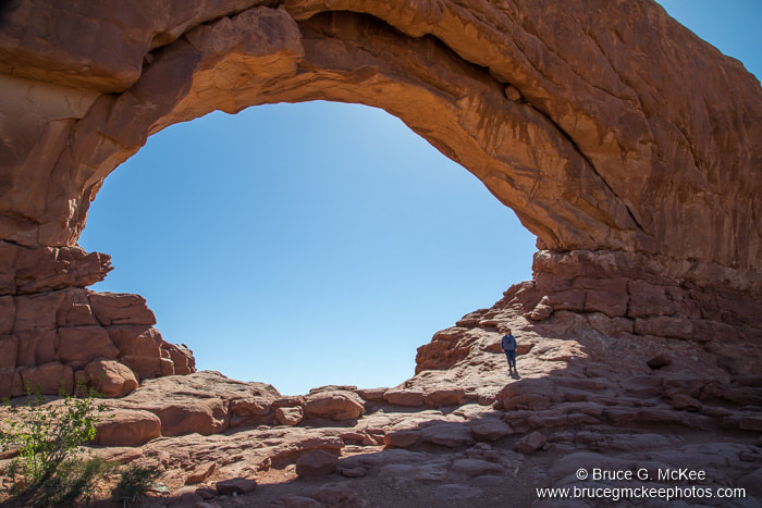
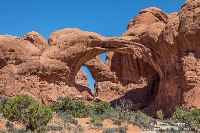
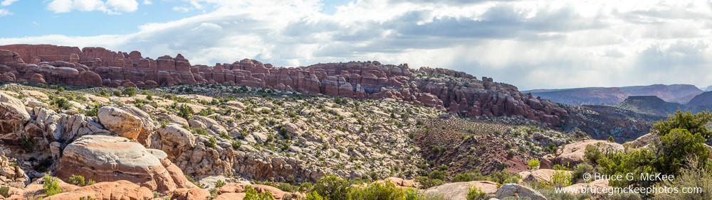
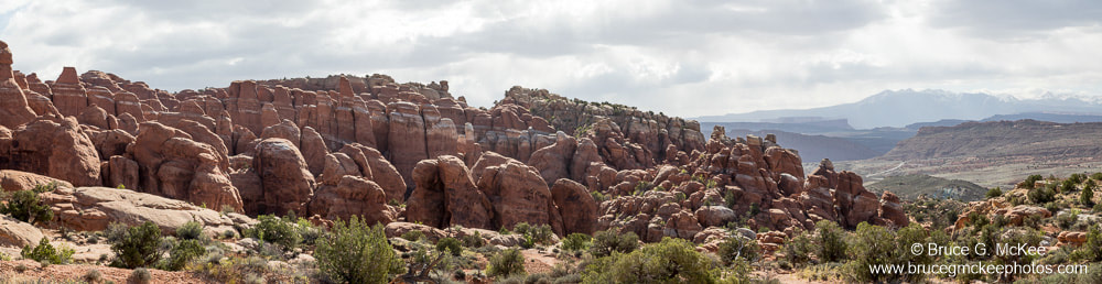
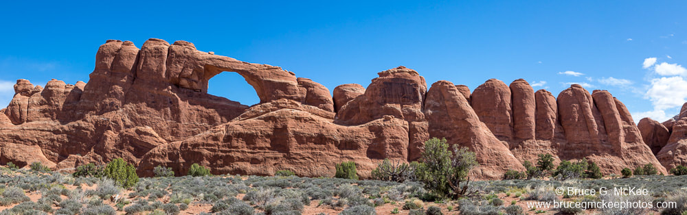
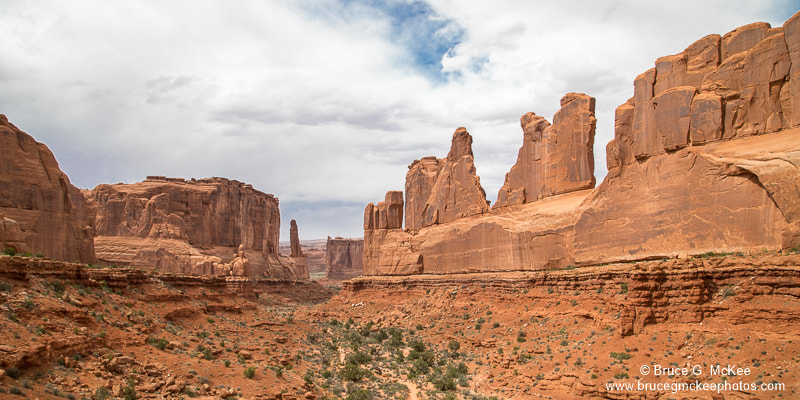
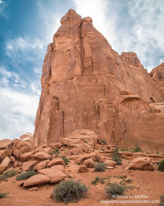
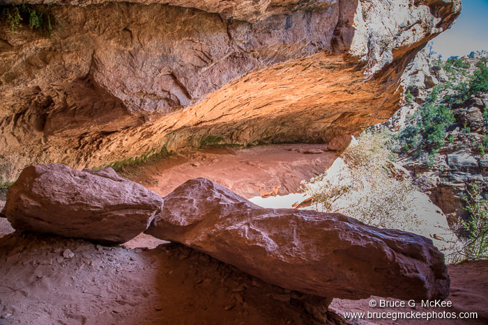
Arches National Park
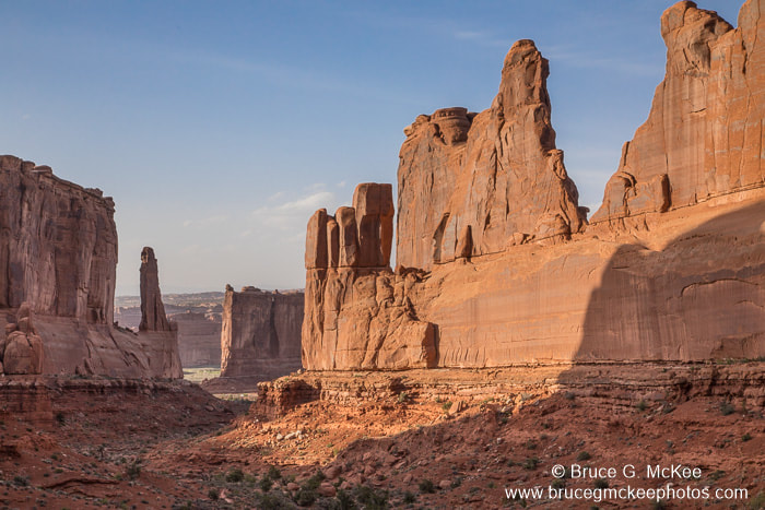
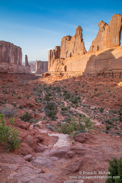
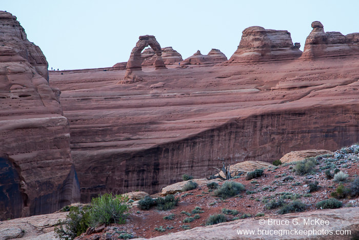
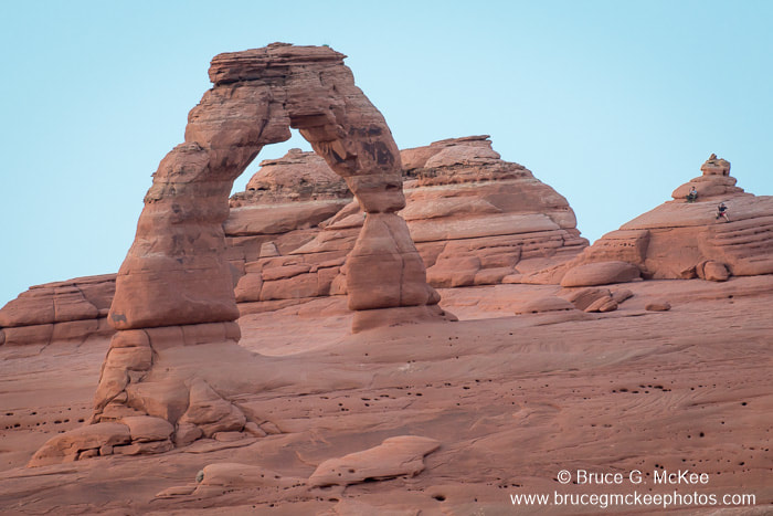
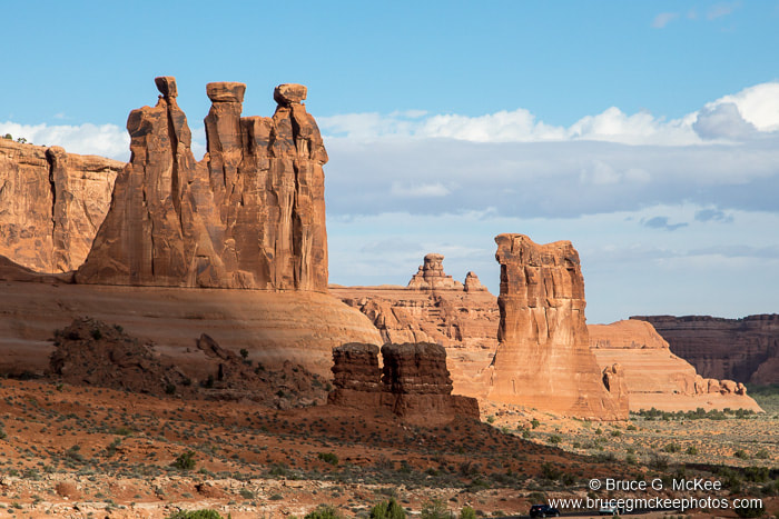
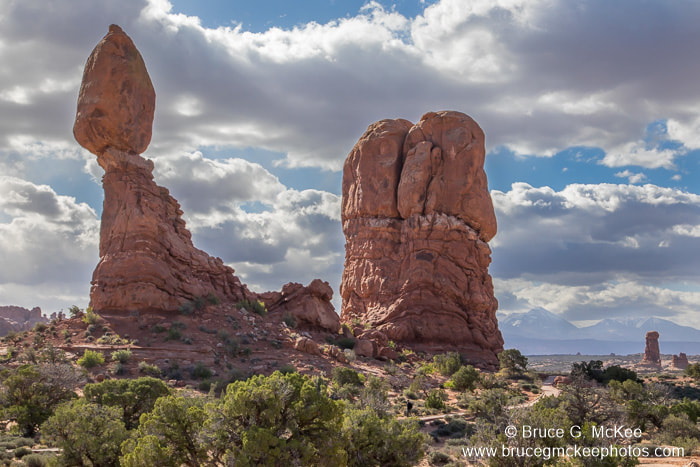
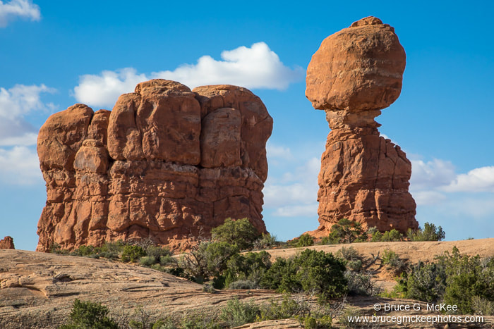
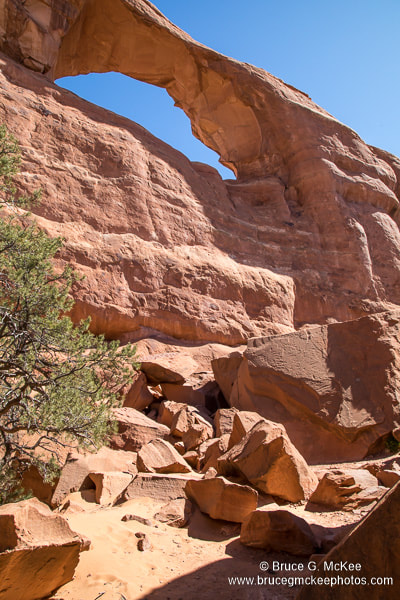
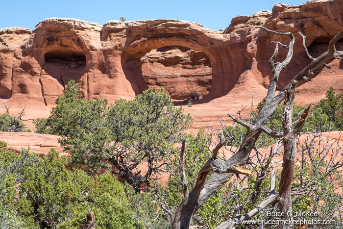
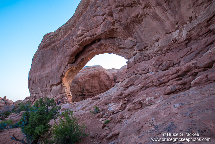
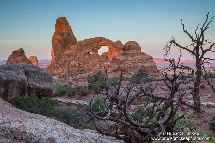
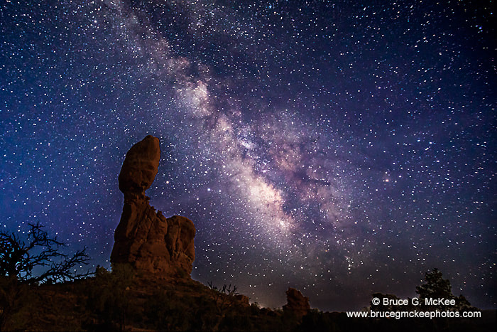
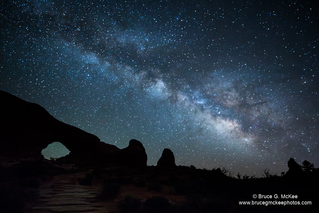
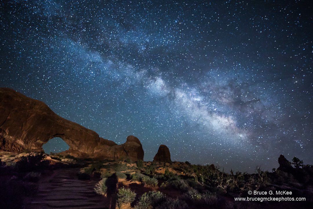
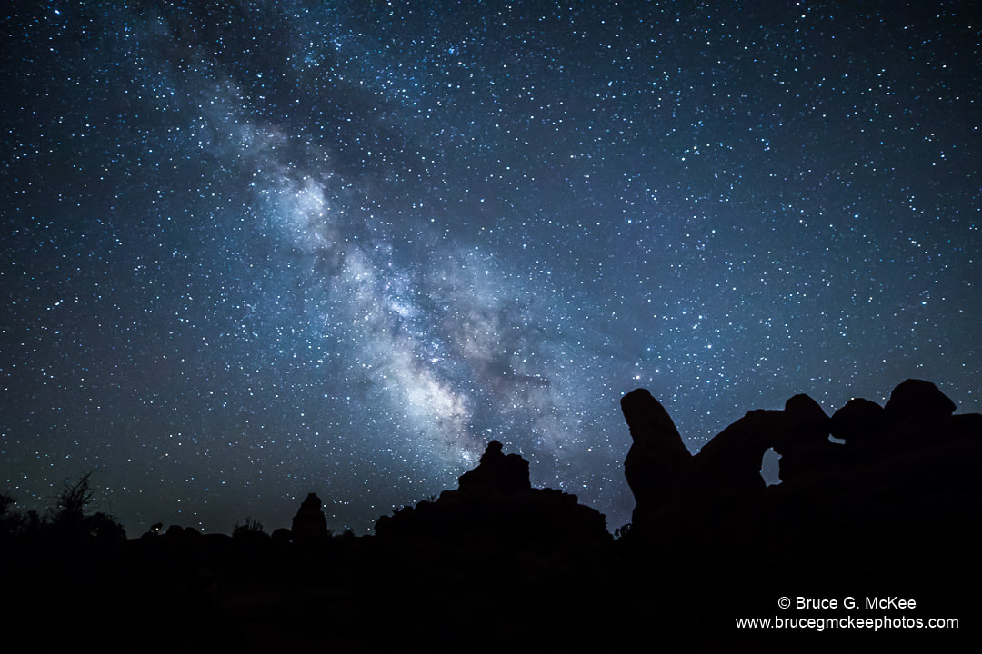
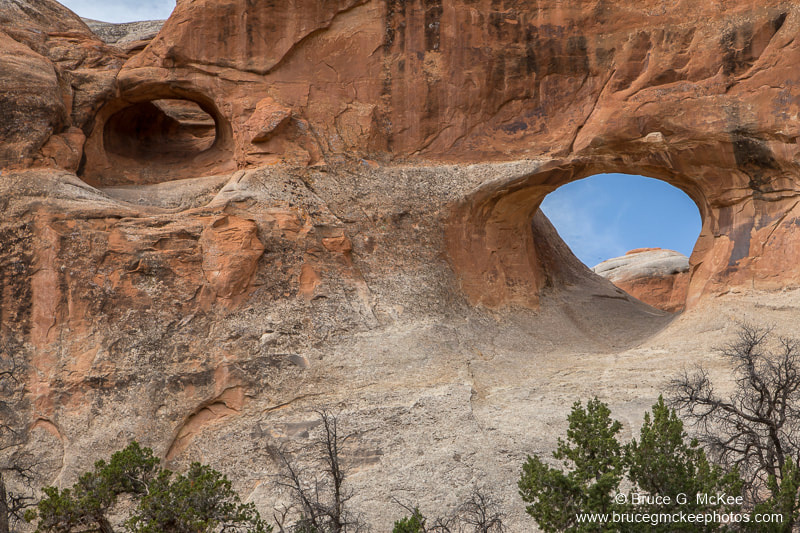
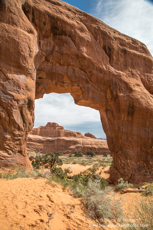
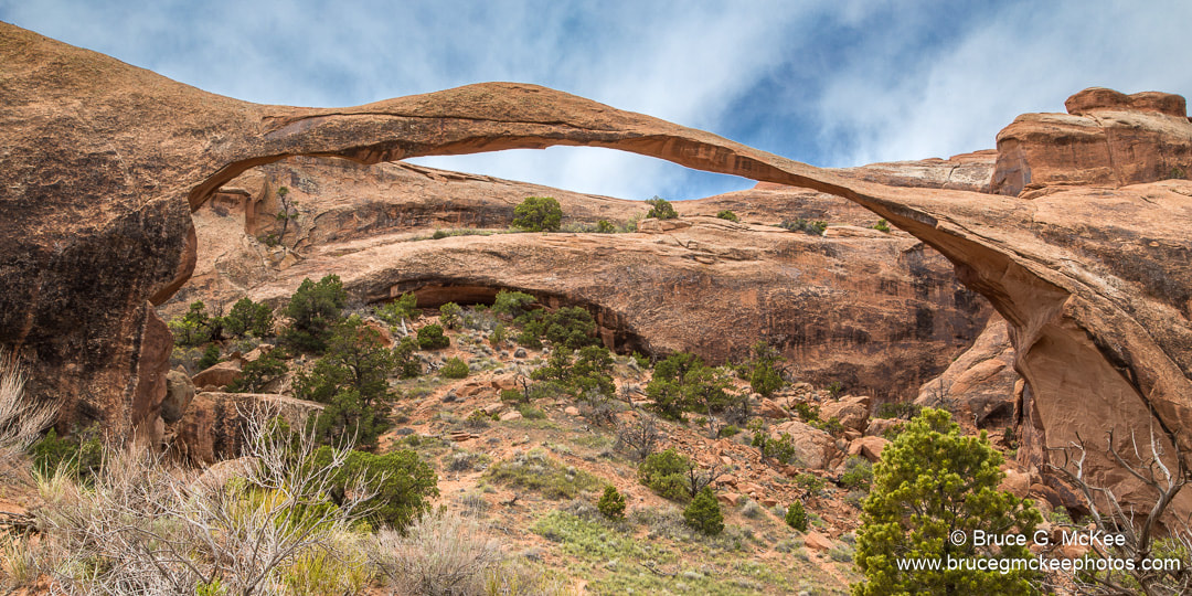
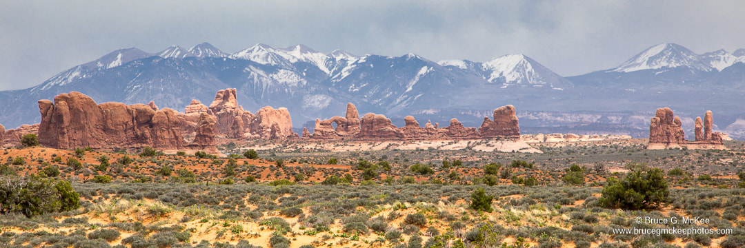
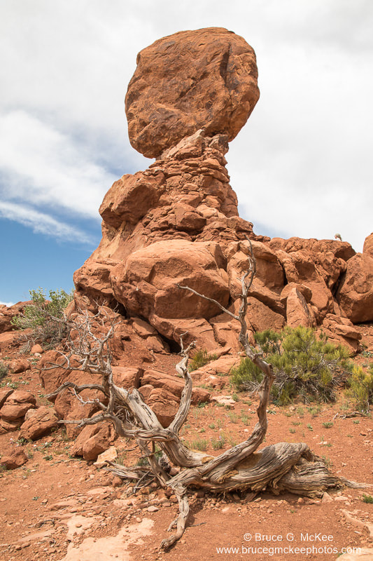
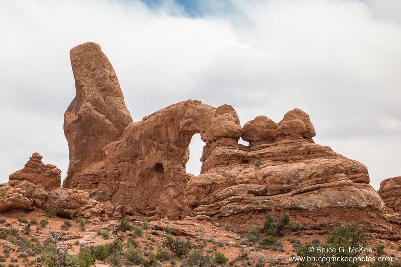
Arches National Park is one of our favorites, from the sheer walls of the 'skyscrapers', towering spires, pinnacles and balanced rocks to the massive arches formed from over a hundred million years of erosion of the sandstone, there is much to see. We drove and then hiked to see the Delicate Arch the first evening we were there and could hardly stand up in the driving wind with the finest sand we have ever seen (or couldn't see). It blew in to every part of our bodies, clothing, and camera equipment. Over parts of three days we saw many of the easy to access arches and sandstone features but did not hike too far off of the main roads. I also went out early one morning before sunrise to photograph the Milky Way behind Balanced Rock.
Click an image to see larger.
Click an image to see larger.


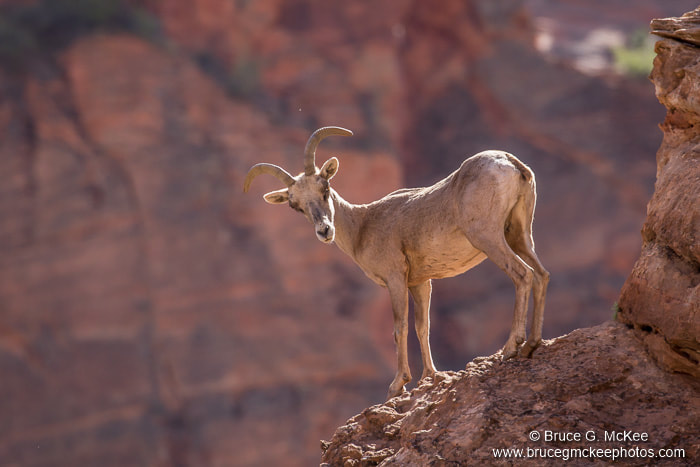
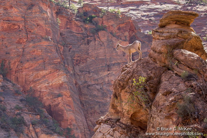
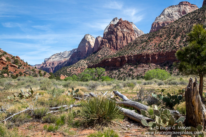
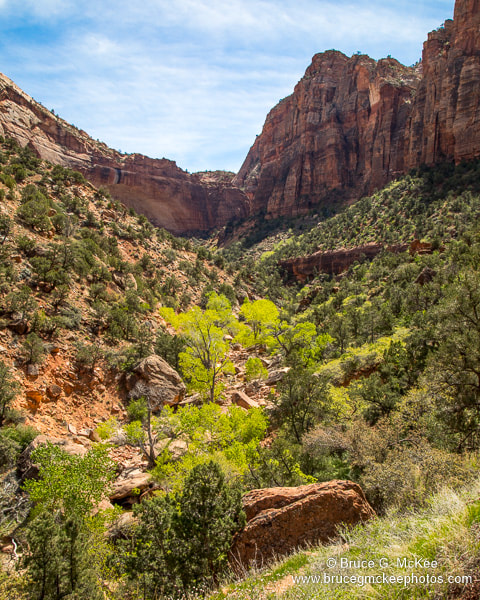
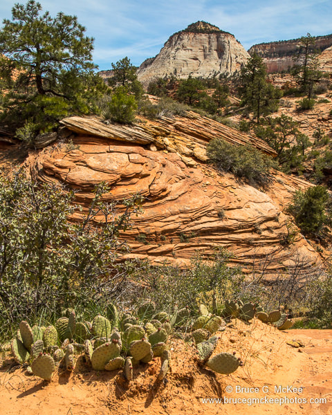
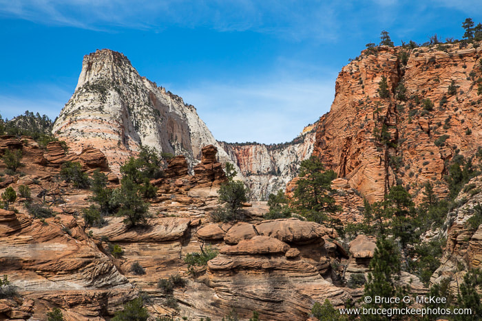
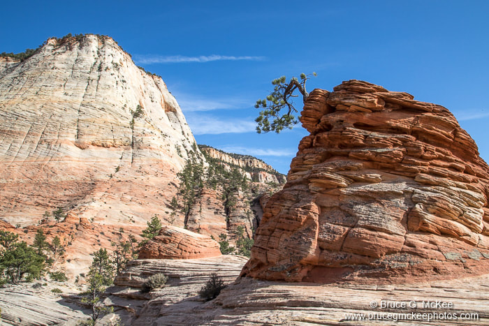
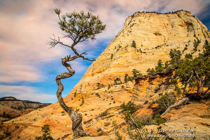
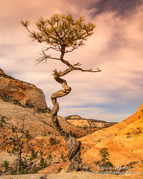
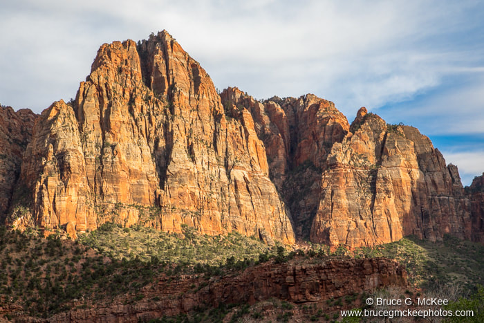
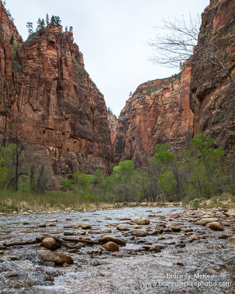
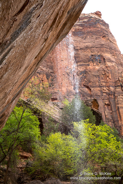
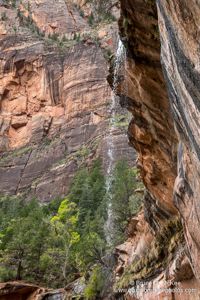
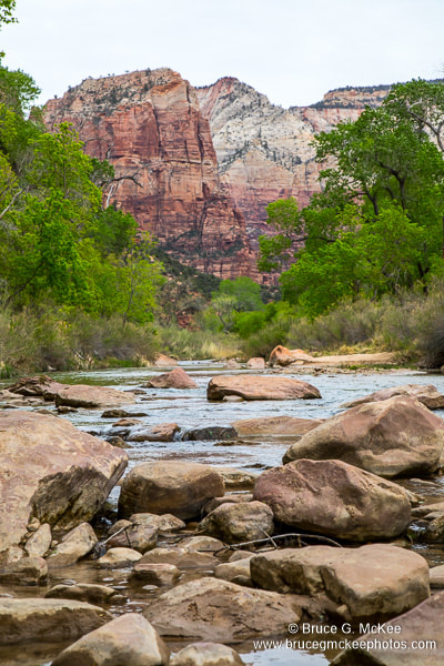
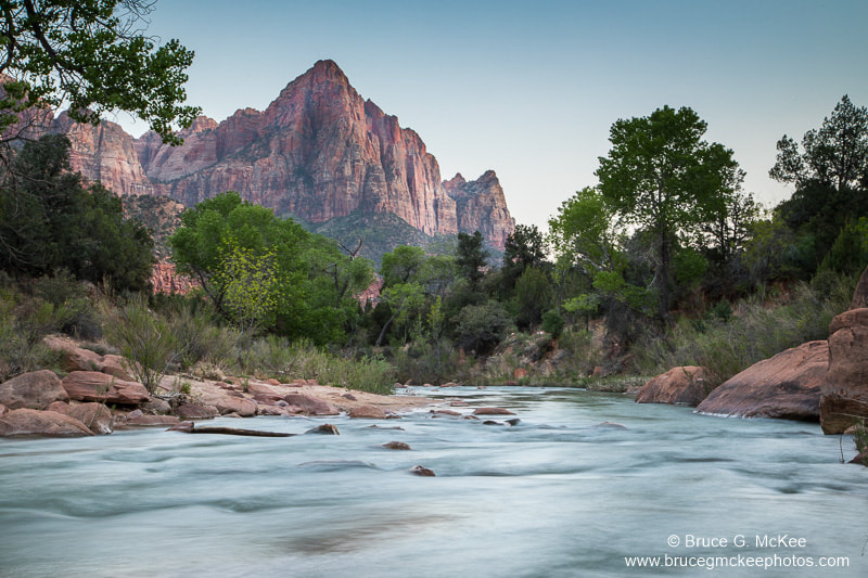
Zion National Park
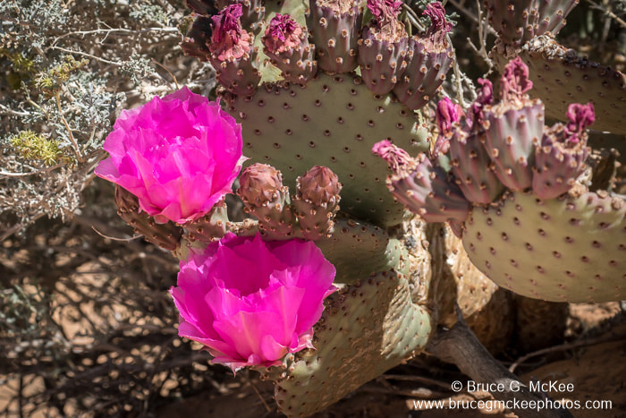
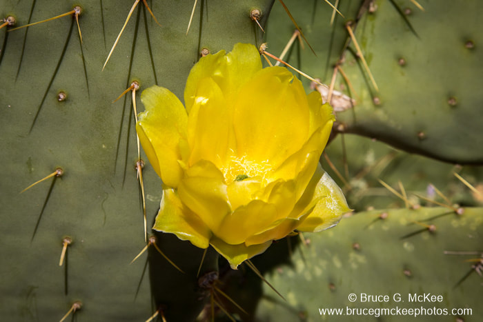
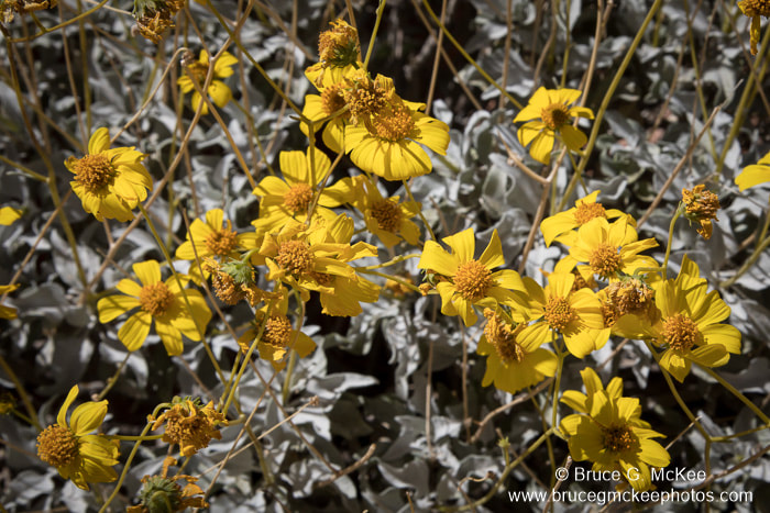
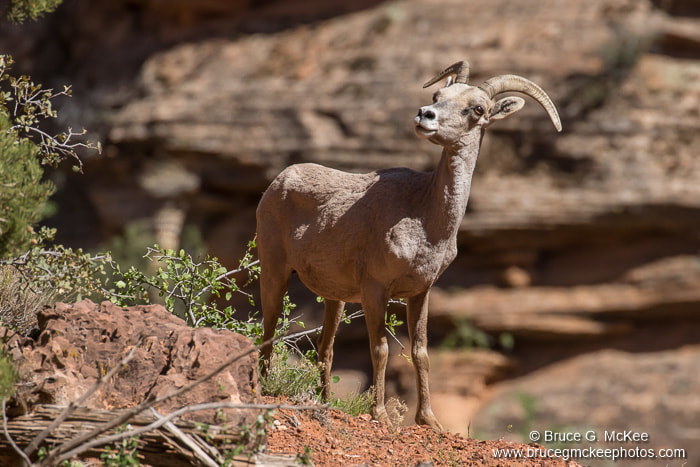
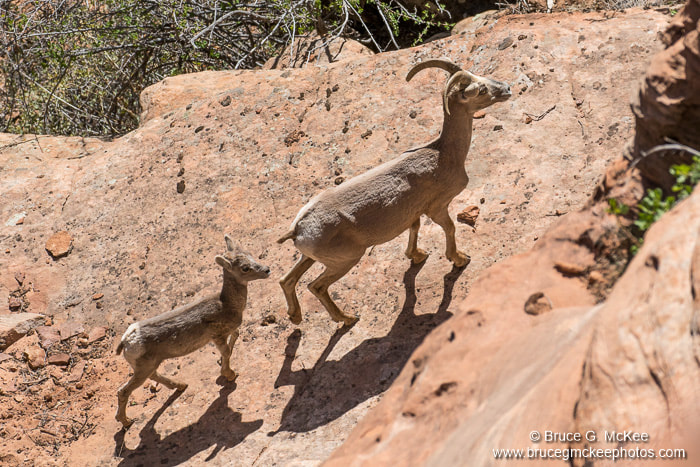
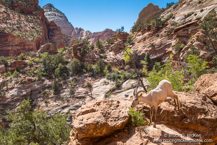
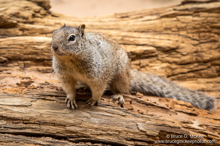
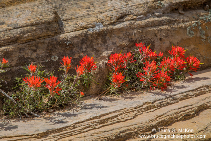
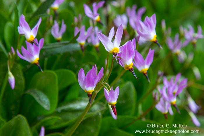
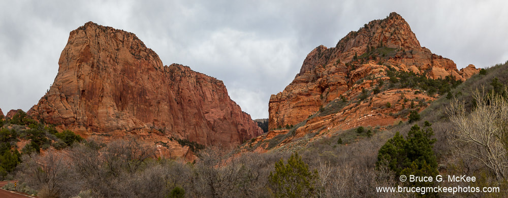
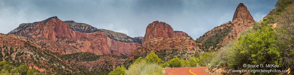
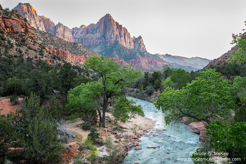
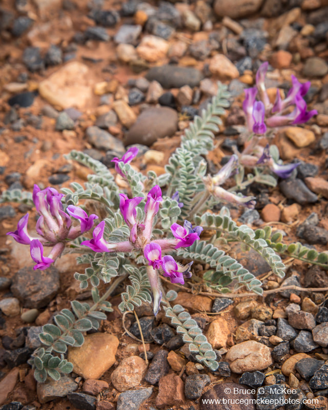
In Zion National Park the terrain was much different than Arches NP with rugged steep mountains and valleys with lots of green vegetation. While hiking the canyon overlook trail we had a fairly close encounter with several Bighorn Sheep. They would climb up and down the steep cliffs as easy as walking on the level, like there was nothing to it. We stopped at an iconic spot along the Zion-Mount Carmel highway in the southern part of the park to photograph a lone pine tree growing out of the side of one of the hoodoos. This tree has been photographed many times by other photographers. Nearby was another pine tree, described to me by a local as the 'corkscrew pine'. A bit difficult to get to, climbing down one steep hill the up a very steep sheer rock face and then up and over some boulders and another cliff to get to it. The river leads up to 'The Narrows' riverside walk, but we didn't have time to get that far up the canyon (maybe on the next trip). The waterfall is the lower Emerald Pool waterfall near Zion Lodge. There were a few flowers blooming in various places, some growing out of tiny cracks in bare rock. The last two photos are from the Kolob Canyons area in the northwest corner of the park.
Click an image to see larger.
Click an image to see larger.


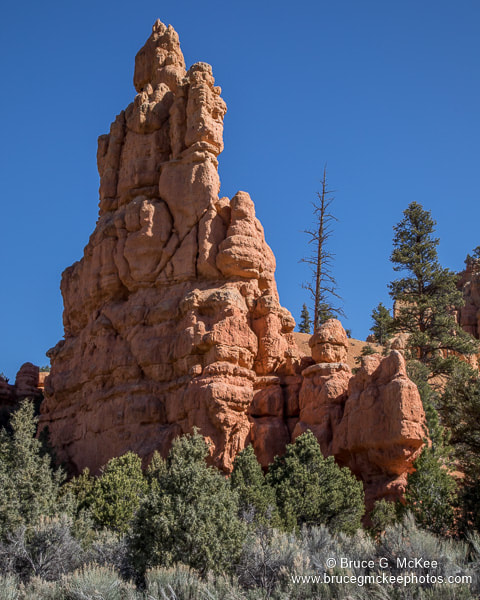
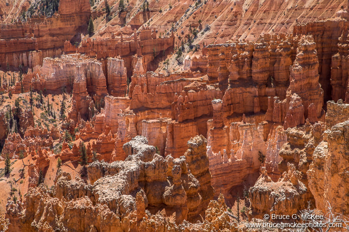
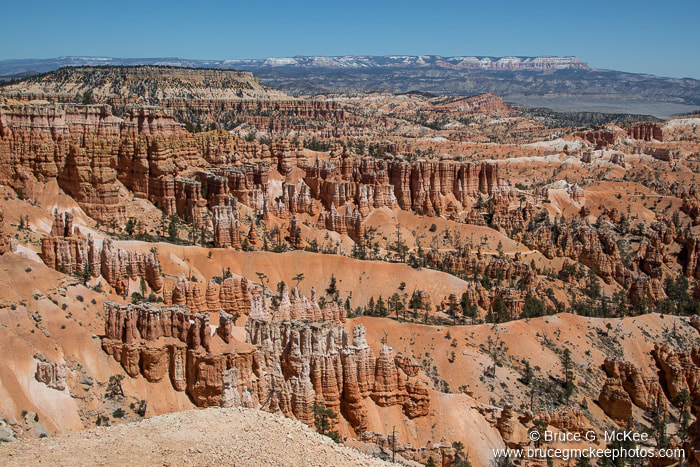
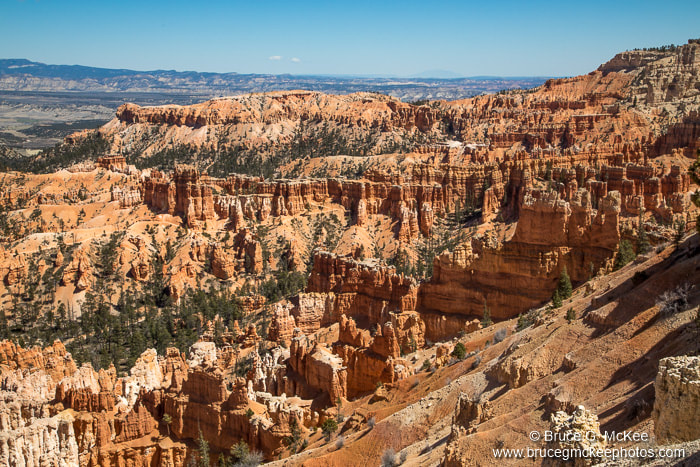
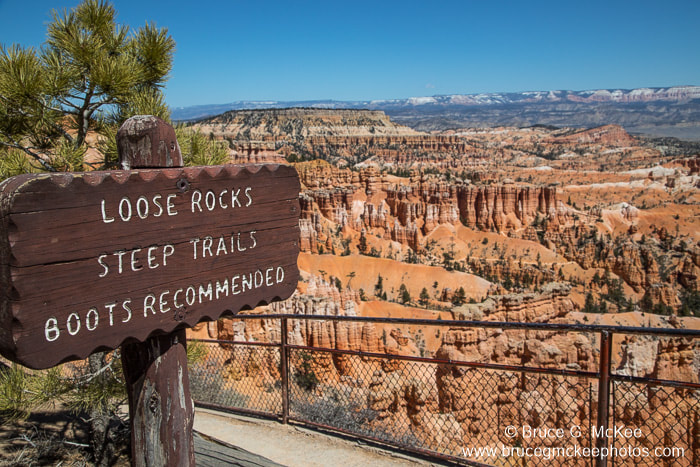
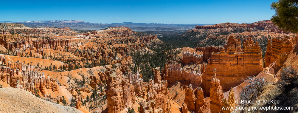
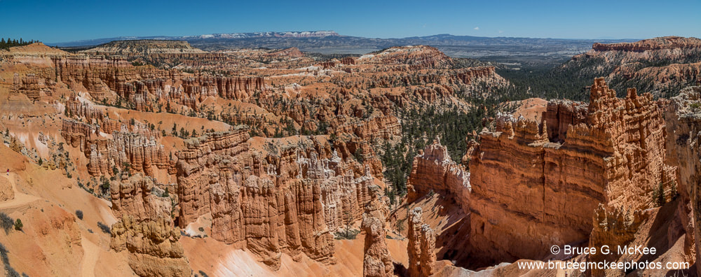
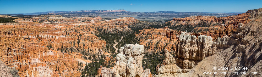
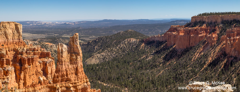
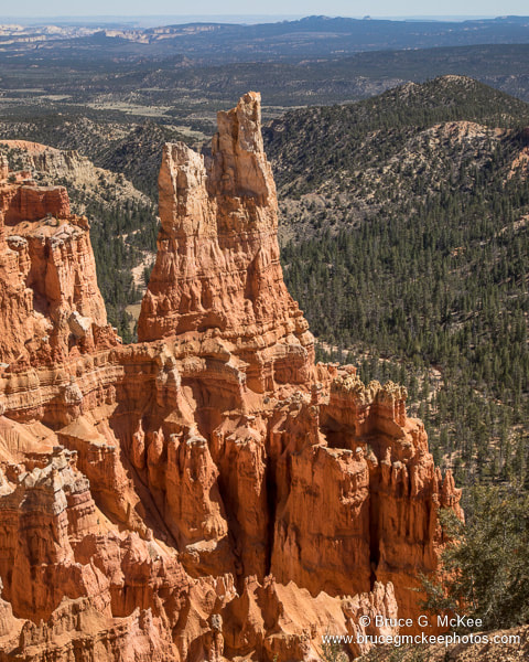
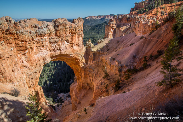
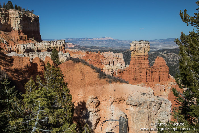
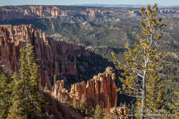
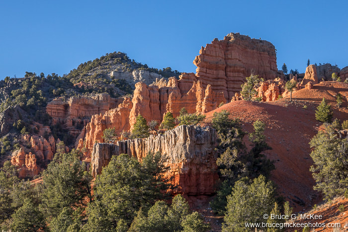
Bryce Canyon National Park
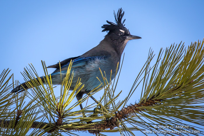
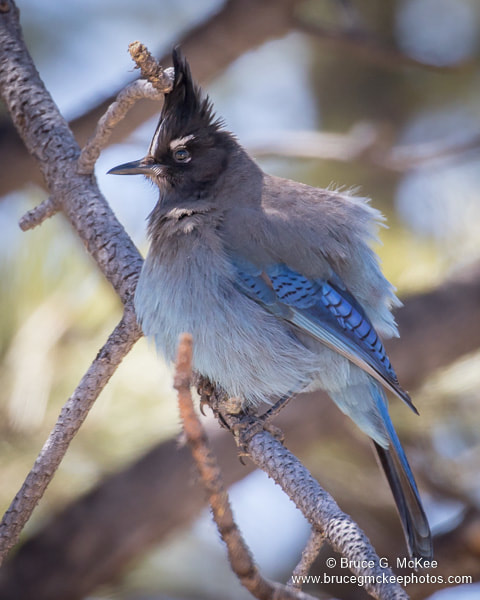
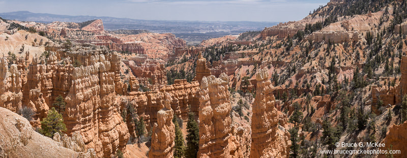
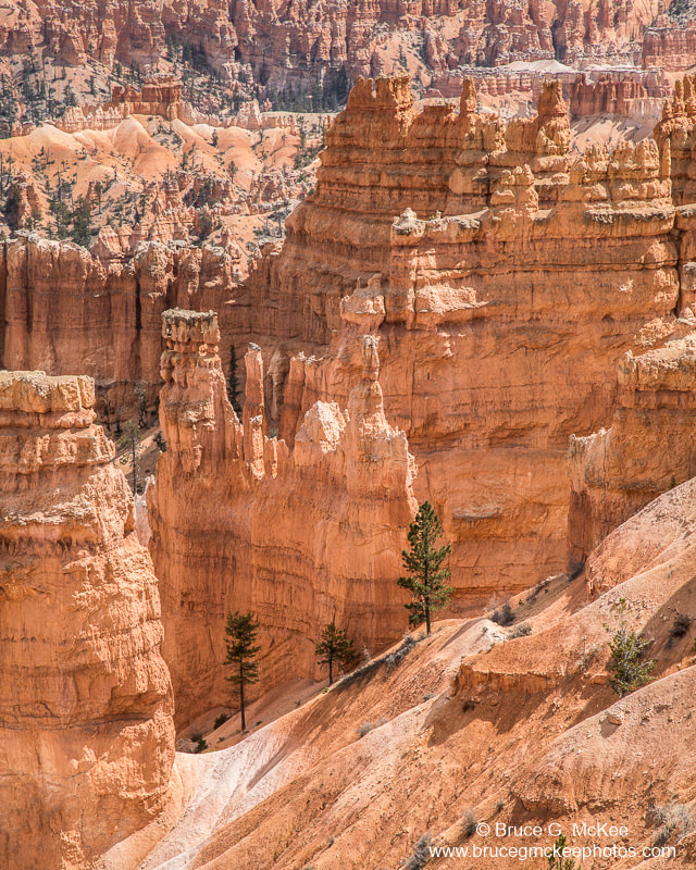
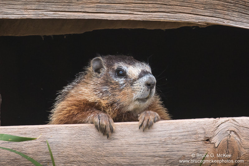
Bryce Canyon National Park is known for the many 'hoodoos' - bulbous weathered columns of limestone that are still changing with every rainfall and freezing/thawing cycle. Bryce is higher in elevation that the other parks that we visited topping out at over 9,100 feet above sea level. Near the visitor center is an area called the Bryce Amphitheater which has the highest concentration of hoodoos. The view is constantly changing as the sun moves across the sky shifting the shadows. There are hiking trails on the rim and down in to the hoodoos to get a view from many angles. We also drove the 18 mile park road to the top at Rainbow Point, stopping at many overlooks along the way. At the lower elevations we saw prairie dogs, mule deer and several small birds. I did follow one Steller's Jay around the parking lot of the visitor center to try to get a photo.
Click an image to see larger.
Click an image to see larger.


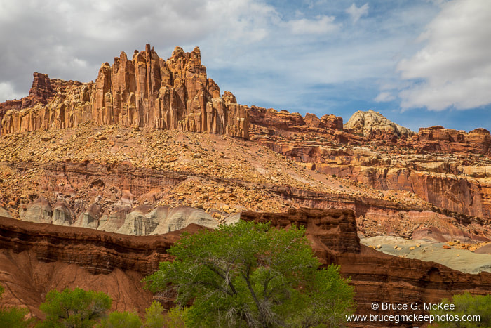
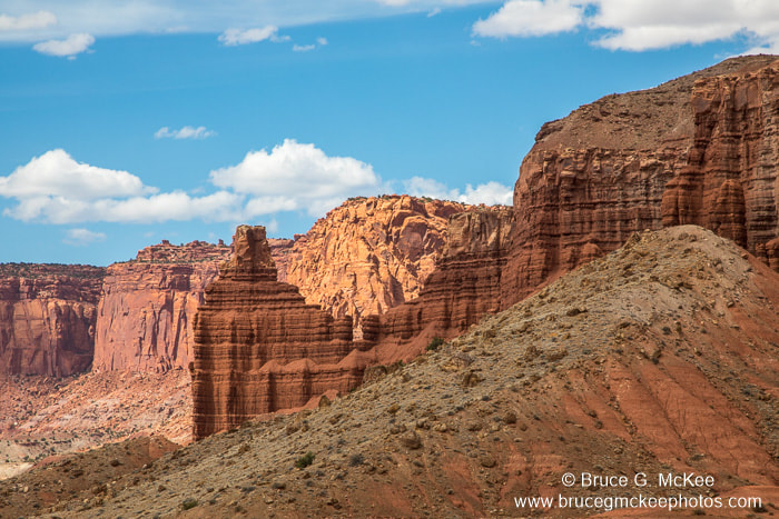
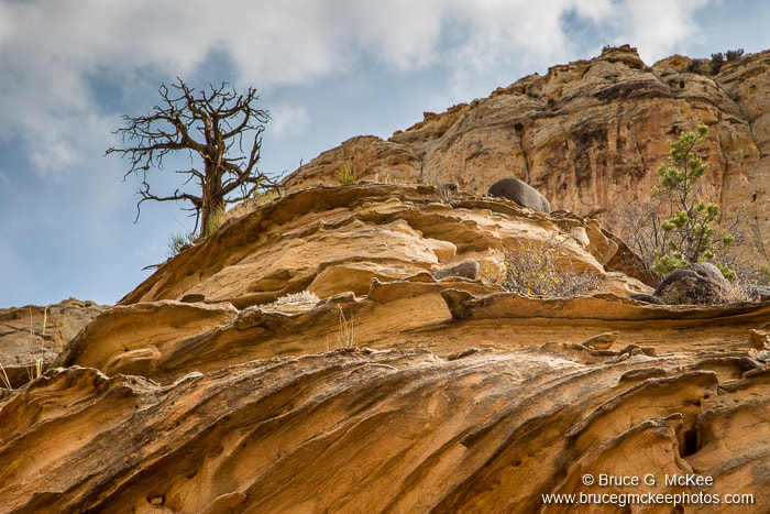
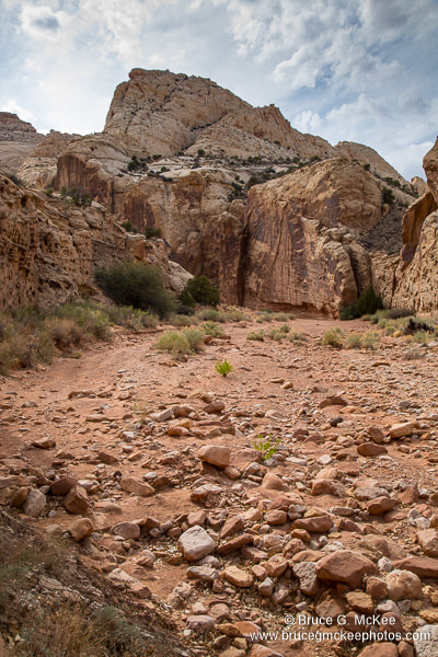
Capitol Reef National Park
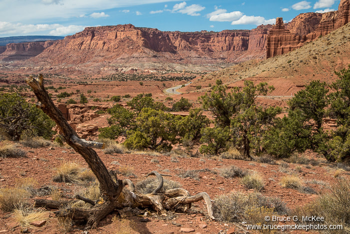
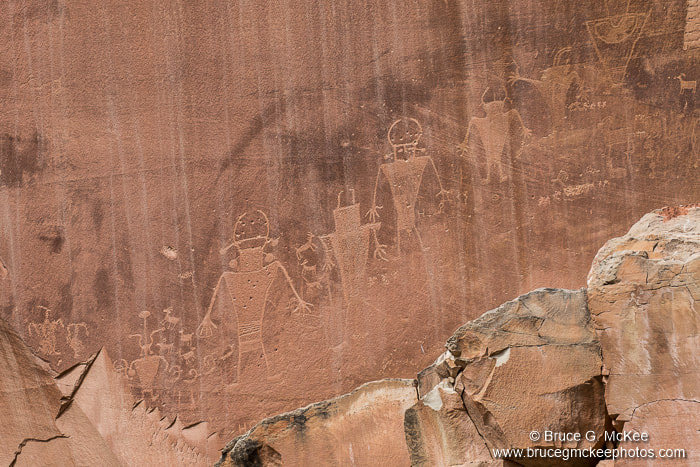
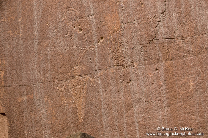
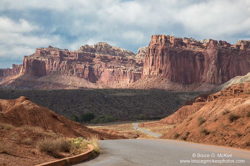
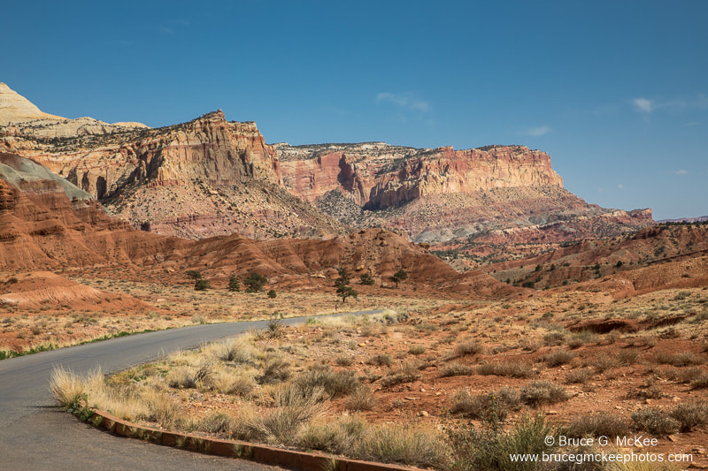
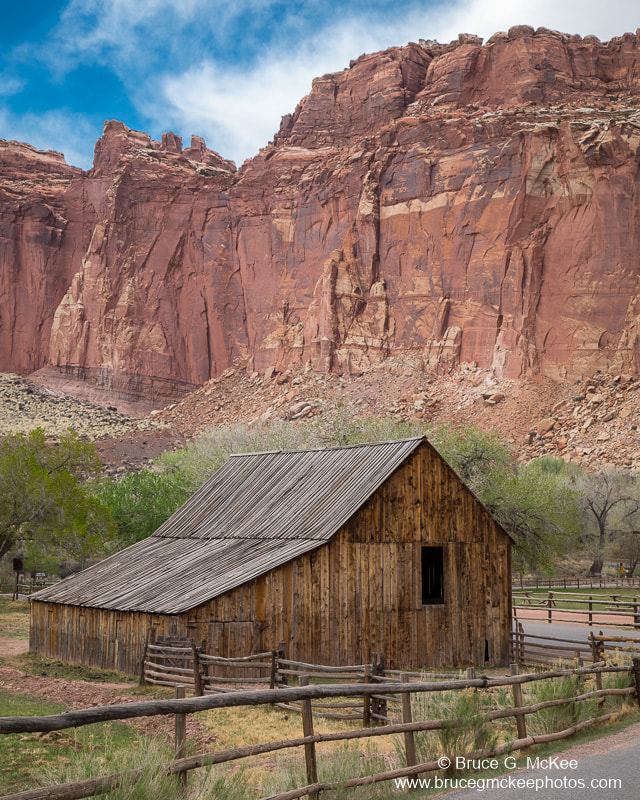
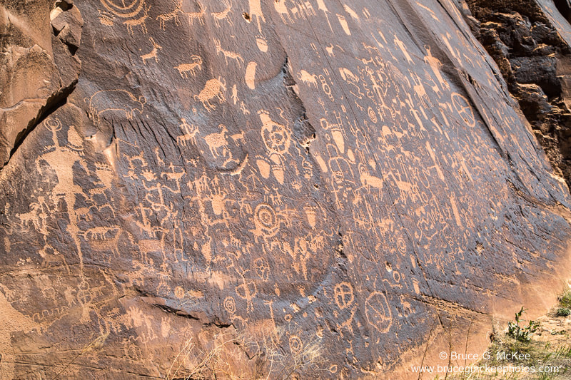
We had a short visit to Capitol Reef National Park as it was en-route to Canyonlands and we didn't have much time to explore. Like the other parks we saw towering cliffs, massive domes and twisting canyons which show many multi-colored layers of sedimentary sandstone and limestone from millions of years of ocean deposits. We also saw ancient American Indian petroglyphs (carvings) and pictographs (paintings) on the sides of cliffs in places that made us wonder how did they get to that location to carve or paint them. These were from people who lived from about 300 to 1300 Common Era (CE) and were ancestors of the Hopi, Zuni and Paiute tribes.
Click an image to see larger.
Click an image to see larger.

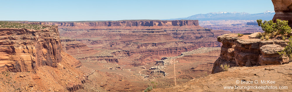
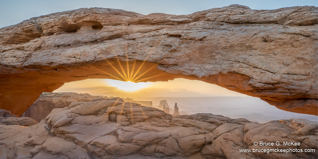
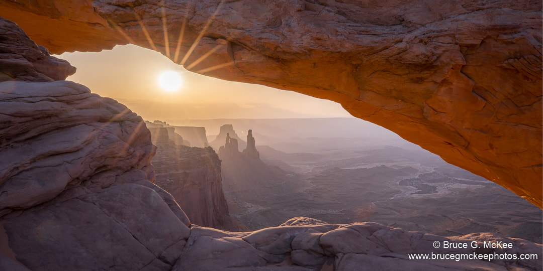
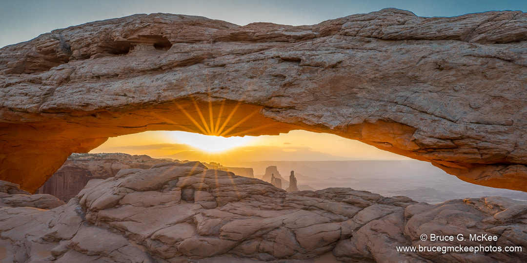
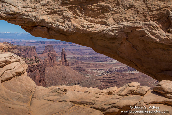
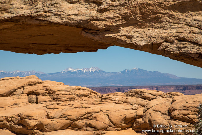
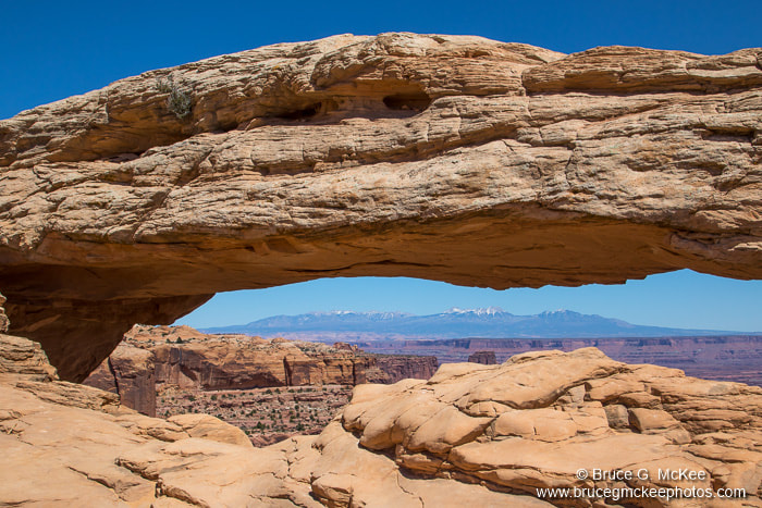
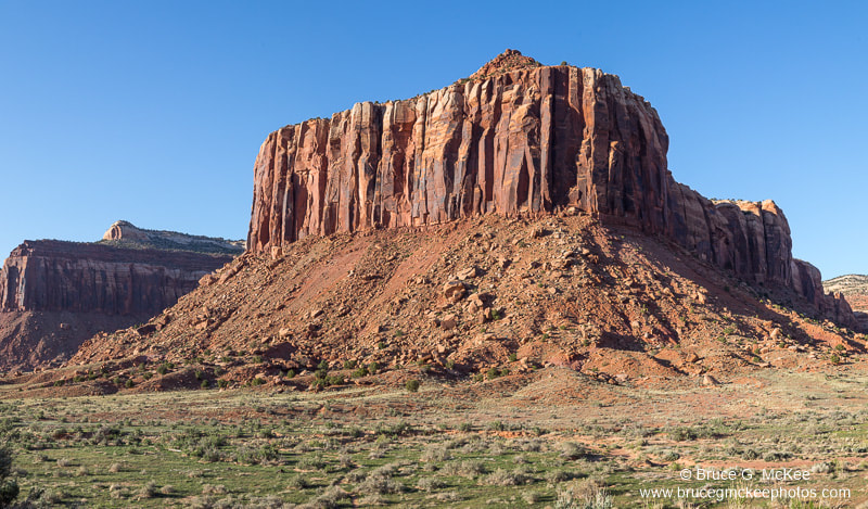
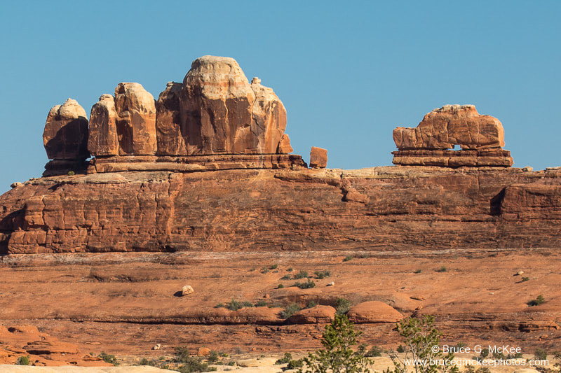
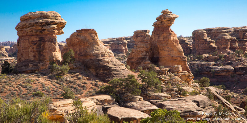
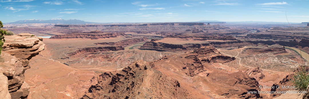
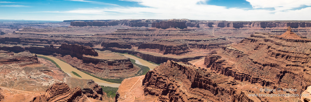
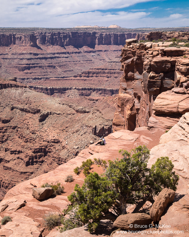
Canyonlands National Park
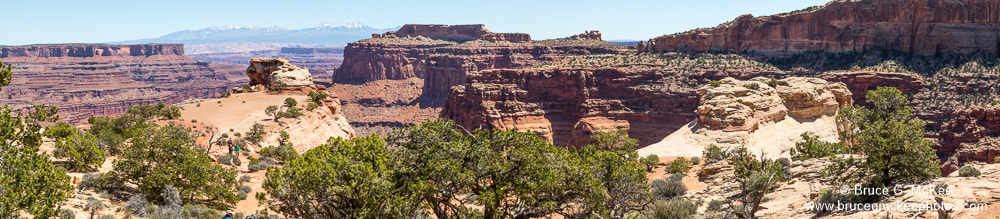
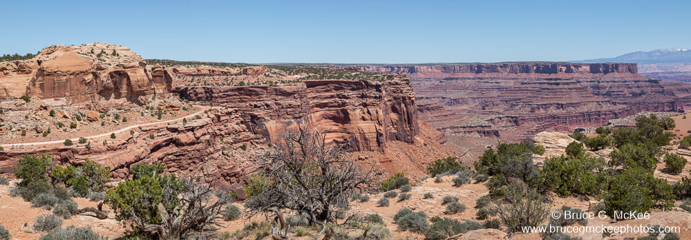
Canyonlands National Park has three distinct regions - the Island in the Sky, the Maze and the Needles -separated by the Green and Colorado Rivers, which have carved deep canyons through many layers of sedimentary rock. Several scenes look very similar to the Grand Canyon (which is on the southern end of the Colorado Plateau). We drove the roads in the Island in the Sky (the north section of the park) and looked out at the spectacular views of the canyons below. We also hiked to Mesa Arch which is well known among photographers as a great spot for sunrise photos. The light hits the under side of the arch as it peeks above the horizon.
Click an image to see larger.
Click an image to see larger.


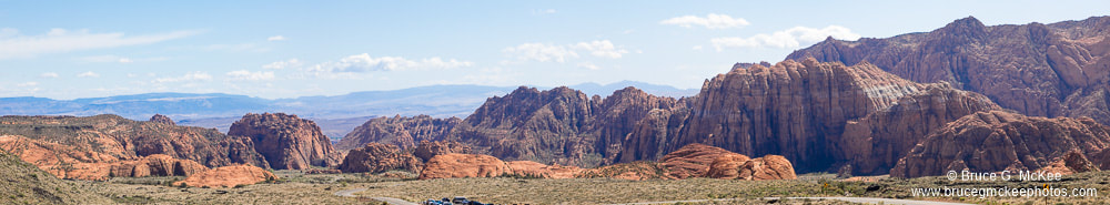
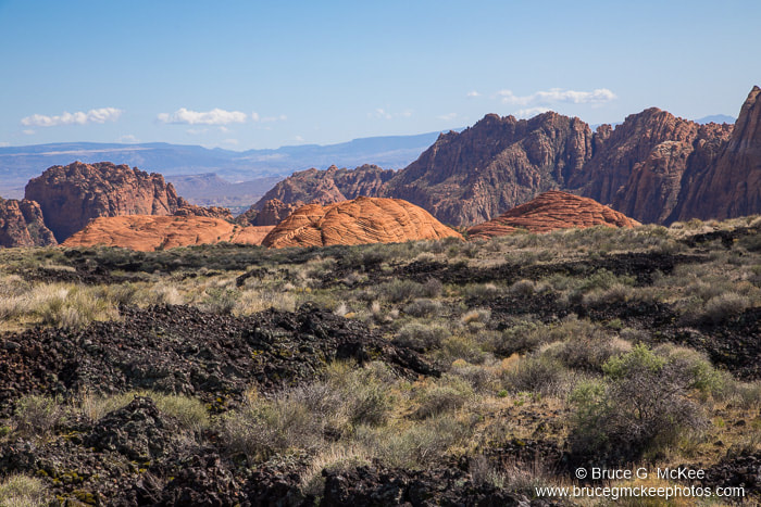
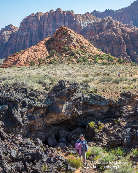
Snow Canyon State Park, UT
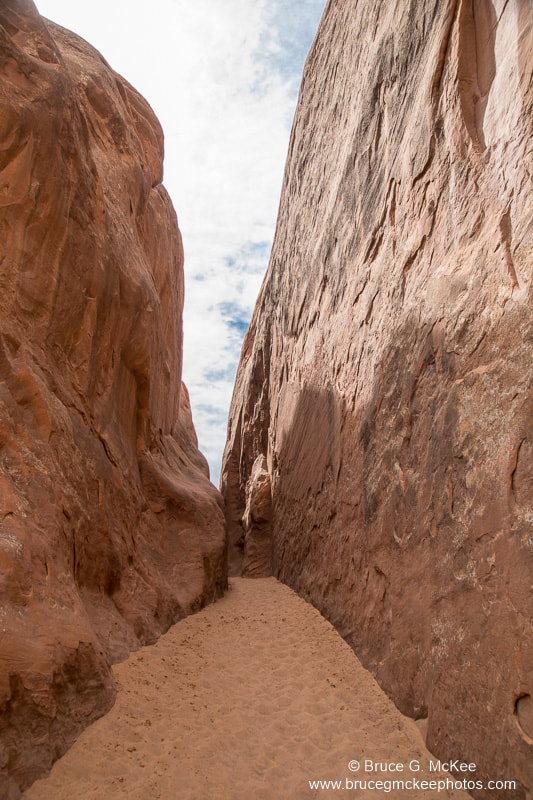
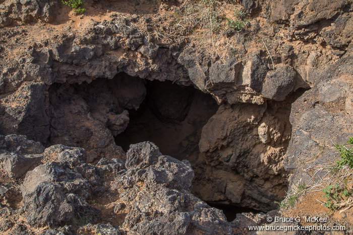
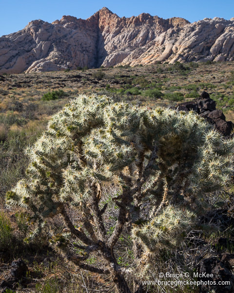
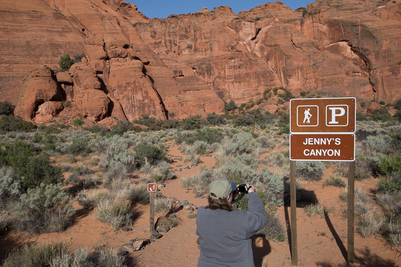
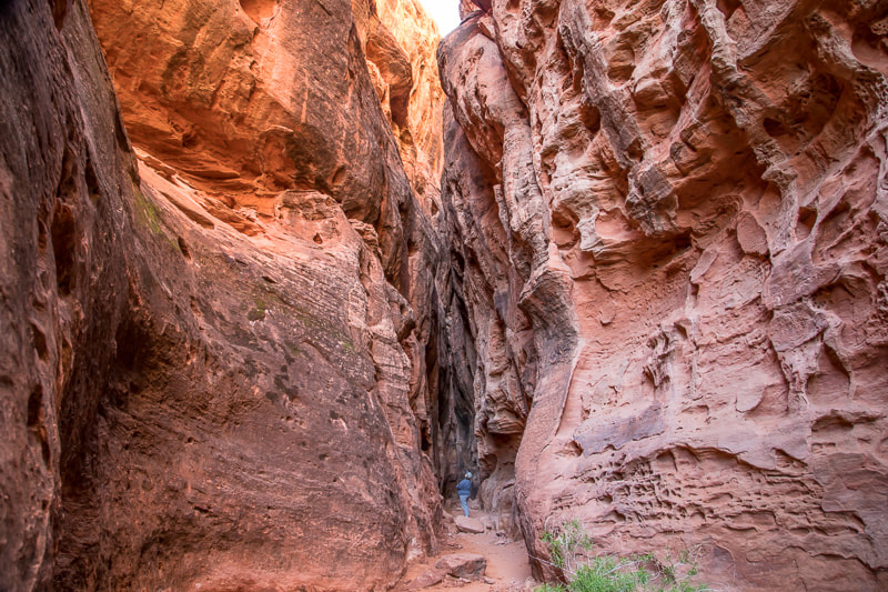
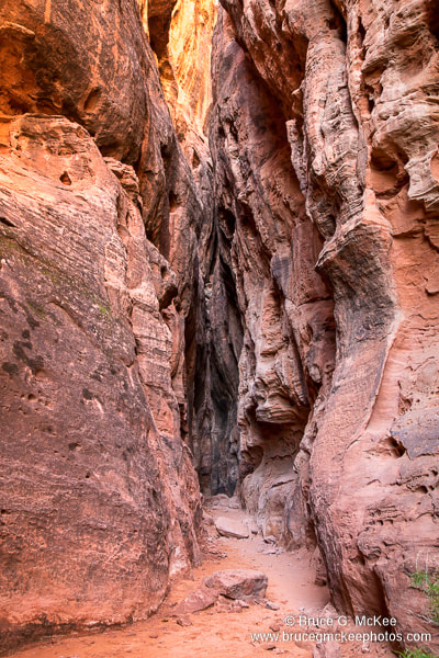
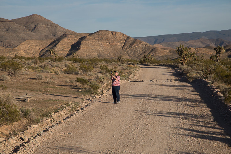
Snow Canyon State Park is near St. George, UT in the southwest corner of the state. This area is a part of the Mojave Desert which includes a small part of southwest Utah, and parts of Nevada, California and Arizona. In addition to petrified sand dunes there are large areas of lava flows from long-ago volcanoes and lava tubes that you can go down in the explore (if you are a little braver than we are). We saw our first Joshua Trees here and explored a small slot canyon.
Click an image to see larger.
Click an image to see larger.
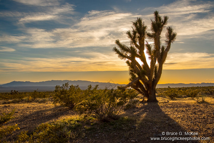
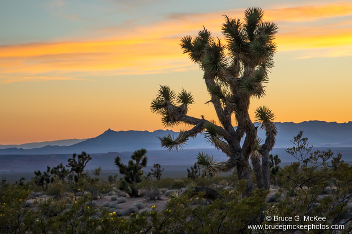
Joshua Tree Forest, Mojave Desert, UT
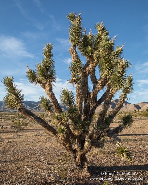
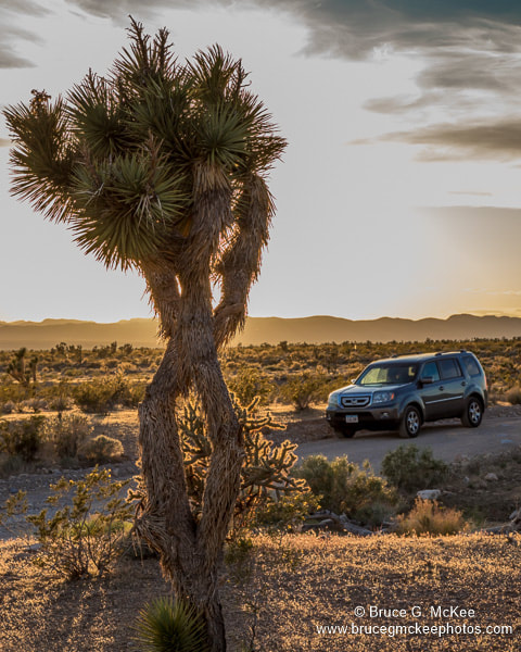
Joshua Trees grow primarily in the Mojave Desert, but can also be found in nearby areas. They are a tree-like yucca plant with spiky leaves that grow in many unique shapes and sizes. This area in the far southwest corner of Utah, only a few miles from Arizona and Nevada, is not really a park, but just a protected area where Joshua Trees grow. We drove a short way on the one road through the area and stopped to take photos of several of the unique trees at sunset.
Click an image to see larger.
Click an image to see larger.
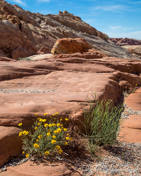
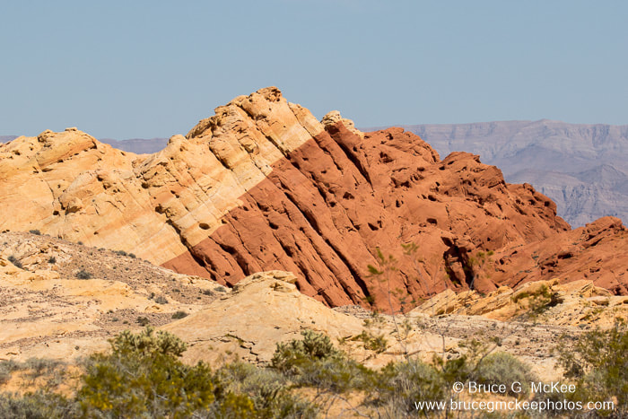
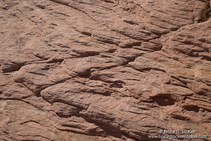
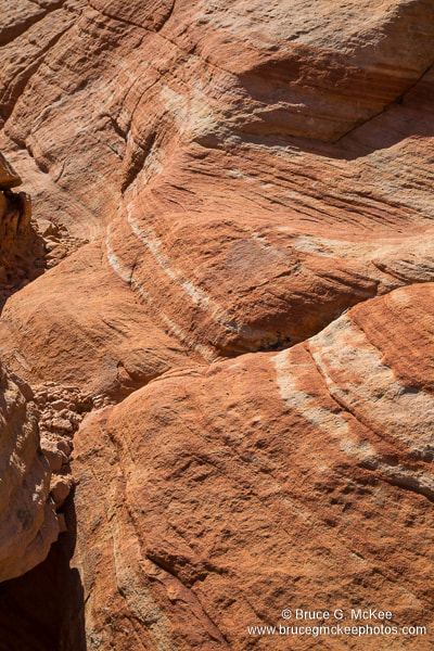
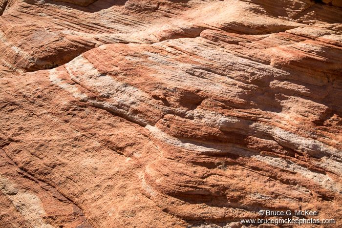
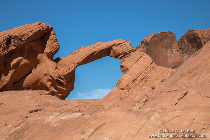
Valley of Fire State Park, NV
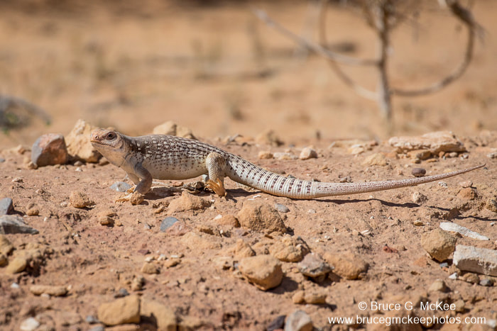
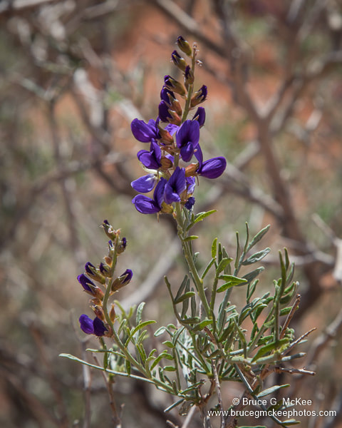
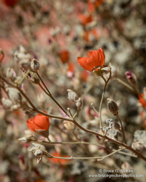
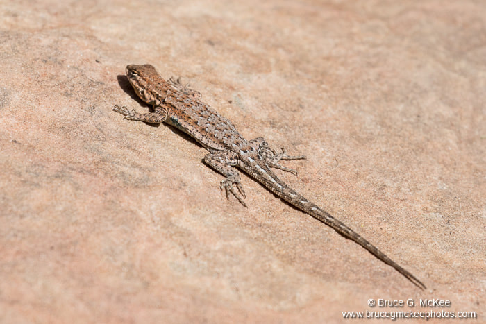
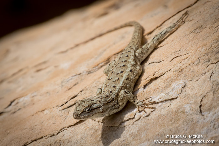
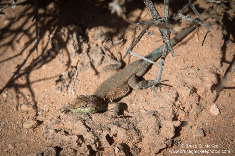
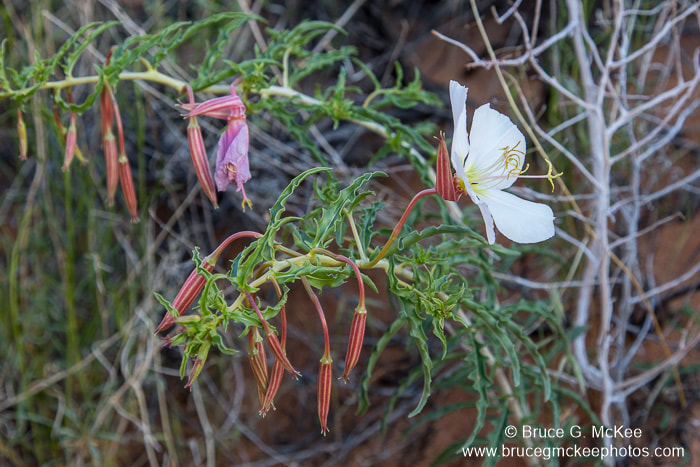
Valley of Fire State Park park is in southeast Nevada near Lake Mead and about an hour from Las Vegas. The name is derived from the red sandstone formed from sand dunes 150 million years ago. It is interesting to see the many different colored layers of sediment, marking different periods of our geologic history and also the incredible forces of nature that push up and tilt or fold millions of tons of rock which are then sculpted by erosion. On our drive through the park we saw the Arch Rock, and a strange bird I had never heard of - a Gambel's Quail, native to the southwest desert part of the United States. We also saw a lot of desert flowers and lizards.
Click an image to see larger.
Click an image to see larger.